The electromagnetic (EM) technique is based on the response of the ground to the propagation of natural electromagnetic field or EM field created by the survey instrument.
The EM survey technique has a number of different applications and can be applied to both reconnaissance and detailed ground investigations. The EM survey method can be used to map the following sub-surface features:
• Geological and hydrogeological features,
• Contaminant plumes,
• Foundations,
• Archeological structures and artifacts.
The following techniques are the main EM approaches using by ZAP Consulting Engineers:
Magneto Telluric (MT)
Time Domain Electro Magnetic (TDEM)
Audio Magneto Telluric (AMT)
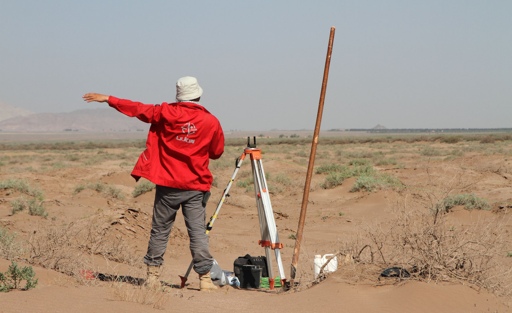
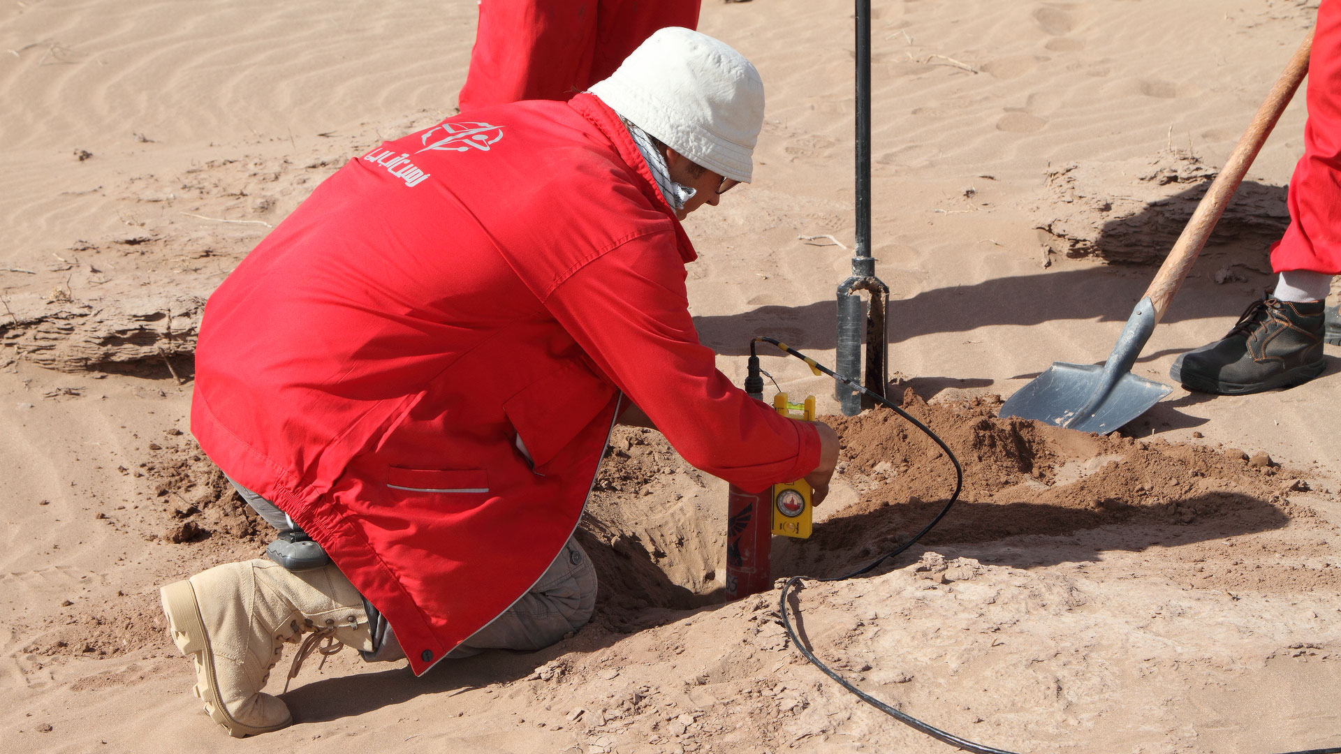
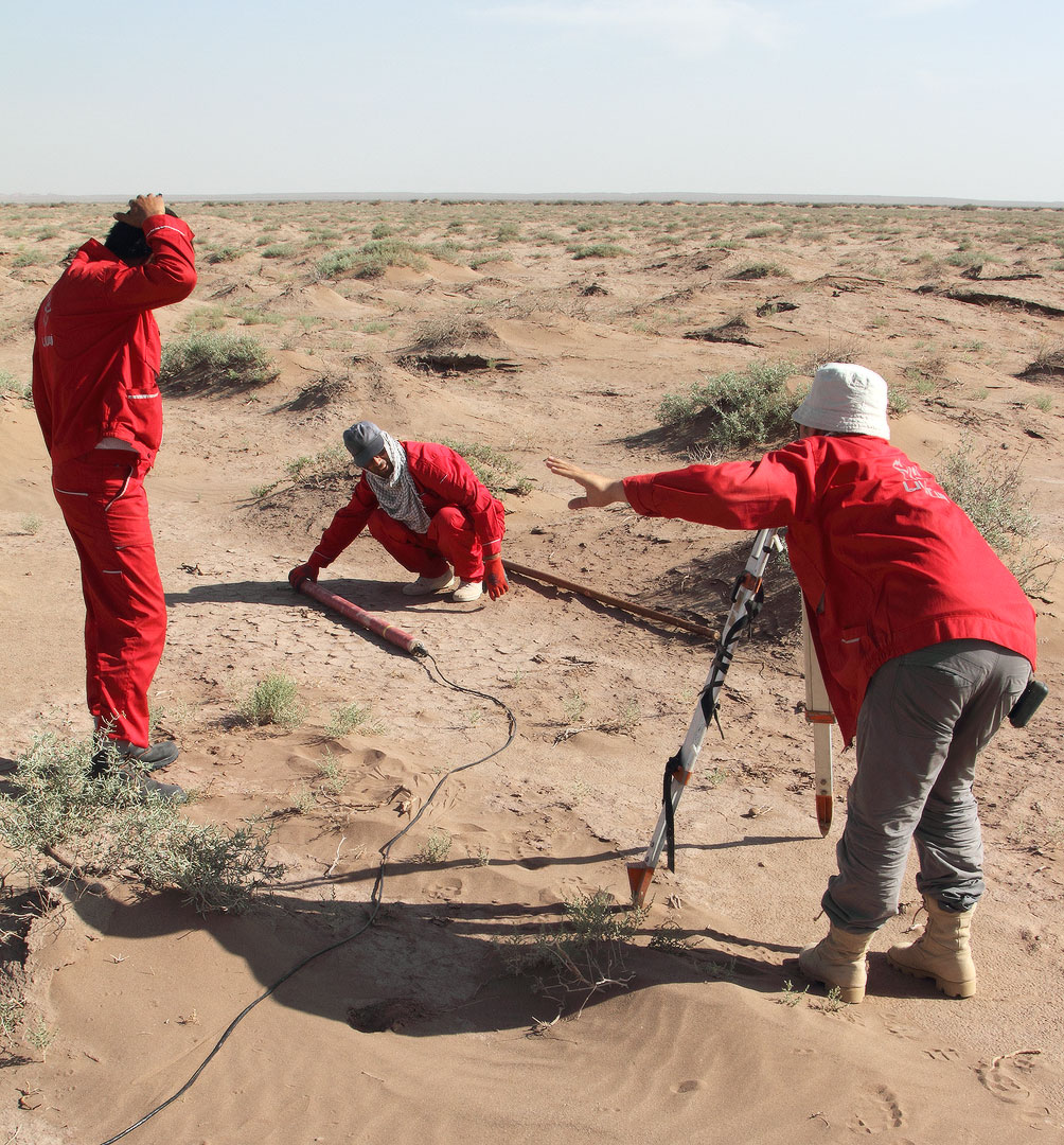
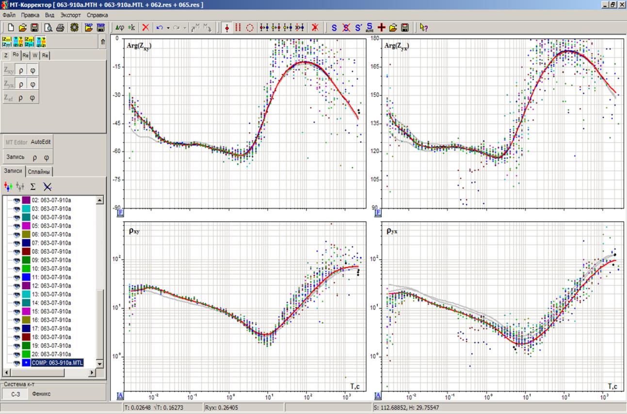
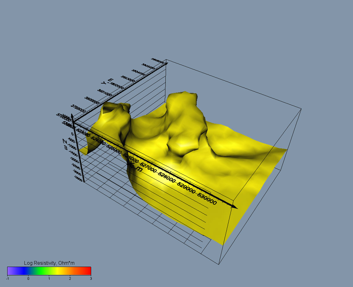
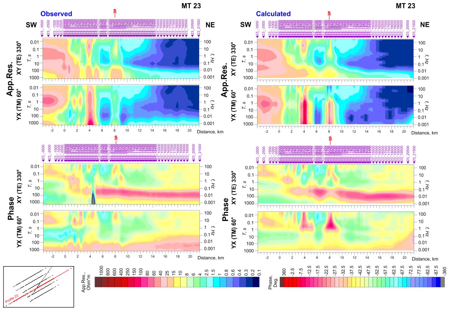
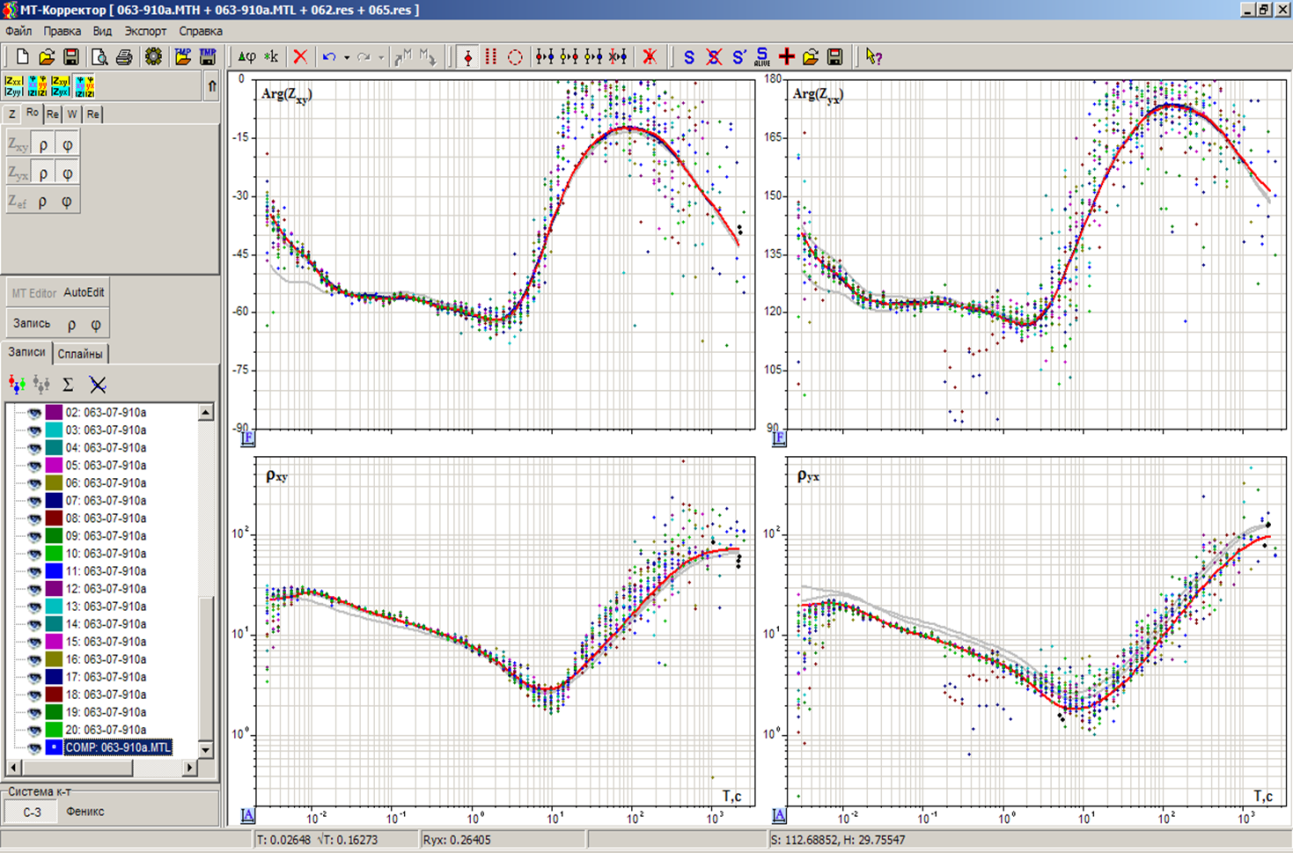
The magnetotelluric (MT) method is a technique for imaging the electrical conductivity (resistivity) and the structure of the Earth, from the near-surface down to the crust and even upper mantle. MT method is a “passive” geophysical method utilizing natural fluctuation of EM field. The depth of the survey in magnetotellurics depends on the period of EM field variations.